Identifying plot center through Hills Post published:January 22, 2019 Post category:Bangladesh Forest Inventory / Images Views: 82 Photo credit: Liam Costello Like224 Dislike28 189800cookie-checkIdentifying plot center through Hillsno You Might Also Like Cutting of Soil samples in coastal region Feni January 22, 2019 Distance measurement using range finder standing in paddy field of Haor area, Hobigonj January 22, 2019 Distance measurement and preparing LF proportioning sketch in village area Rajshahi January 22, 2019
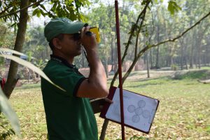
Distance measurement using range finder standing in paddy field of Haor area, Hobigonj January 22, 2019