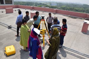
Setting DGPS rover into BFI plot center in Sundarbans Post published:January 22, 2019 Post category:Bangladesh Forest Inventory / Images Views: 137 Photo credit: Mondal Falgoonee Kumar Like224 Dislike28 199400cookie-checkSetting DGPS rover into BFI plot center in Sundarbansno You Might Also Like First DGPS training of BFI April 11, 2017 Training on Open foris collect April 4, 2018 Leaf cover measurement using Densitometer January 22, 2019