The Bangladesh Forest Inventory:
Results at a Glance

What is the Bangladesh Forest Inventory?

  • A national multi-purpose tree and forest monitoring system
  • Robust estimates of the status of tree and forest resources and their value as ecosystem services
  • Baseline information about natural resources in support to sustainable land management, planning, policy decisions, national and international reporting

Monitoring on the basis of 7 criteria and 47 indicators

Forest extent and tree cover change
  • Extent of trees and forests
  • Tree cover changes
Management and ownership
  • Tree and forest management types
  • Trees and forest by ownership class
  • Tree and forest product collection by ownership type
Biological diversity and conservation
  • Tree species characteristics
  • Plant diversity index of trees
  • Status of native and introduced tree species
Tree and forest disturbances
  • Disturbance area
  • Drivers of tree cover change
Tree and forest services and livelihoods
  • Quantity collected, value, and income
  • Involvement with tree and forest related activities
  • Services and benefits from trees and forest
  • Dependence on trees and forests for energy
  • Total annual income from trees and forest
Growing stock biomass and carbon
  • Growing stocks
  • Tree biomass
  • Dead biomass and fuelwood
  • Carbon
Sustainable forest management
  • Types of support received from organizations
  • Households receiving seedling support
  • Seedlings purchased by households

How we collected data

BFI Zones

Village Zone

All area not occupied by the Hill, Sundarban, Sal or Coastal zones. Common tree species are Swietenia mahagoni, Areca catechu, Mangifera indica, Acacia auriculiformis, Samanea saman, and Eucalyptus camaldulensis.

zone_new

Zones of Bangladesh

Note that zones are not strictly defined by land use, rather they are generalized areas used to reduce estimation error. Therefore, the Village zone may have within its boundaries forest area, or the Hill zone may have village areas, etc.

Sal Zone

Areas in Madhupur and Barind tract with small hillocks and plain land, consisting of mainly deciduous Sal forest. Common tree species are Shorea robusta, Albizia spp., Artocarpus heterophyllus, Swietenia mahagoni, Acacia auriculiformis etc. and homestead tree species such as Mangifera indica.
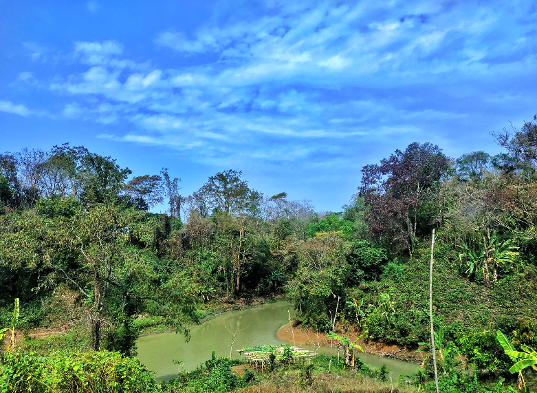
Sundarban Zone

Natural mangroves of the Sundarban Reserve Forest found in the south-western part of the country. Common tree species are Heritiera fomes, Excoecaria algallocha, and Ceriops decandra.

Hill Zone

Hilly areas in the eastern part of the country. Common tree species are Dipterocarpus spp., Syzygium spp., Gmelina arborea, Ficus carica, Grewia spp., Albizia spp., Acacia auriculiformis, Artocarpus heterophyllus, Swietenia mahagoni, Tectona grandis, Acacia auriculiformis, and homestead tree species such as Mangifera indica.

Coastal Zone

Areas with accreted land in the southern part of the country. Common tree species are Sonneratia apetala, Avicennia officinalis, Excoecaria agallocha, Areca catechu and homestead tree species such as Artocarpus heterophyllus, Samanea saman, Azadirachta indica and Mangifera indica.

Land Cover Map

  • Follows the Land Cover Classification System (LCCS) and LCML ISO 19144 standard
  • Developed with Object-Based Image Analysis (OBIA) approach
  • 33 land cover classes determined by participatory process involving multiple stakeholders
  • 1000 field data collection points

Biophysical Inventory

  • 1781 biophysical plots permanently established covering all land covers
  • 775 plots were located in croplands where soils and other data were collected.
  • Targeted national precision of ±5% and 90% confidence interval for tree resource estimates
  • Sample intensity optimized by considering cost, accessibility, and desired precision.
  • Field quality control performed on 5% of the plots
In the Hill, Sal, Coastal and Village zones one plot is composed by five sub-plots (A). In the Sundarban zone, one plot is composed by three sub-plots (B).In each subplot (C), seedling and sapling information was collected from the S plot. Trees having a Diameter at Breast Height >10 cm to 30 cm was collected from the M plot. All trees >30 cm DBH was collected from the L plot.Other Data collected in each plot were:
  • Bamboos (species, diameter, height and culm count)
  • Standing dead trees and stumps (height, diameter)
  • Down woody debris
  • Soil and litter samples
  • Crop management
  • Land feature description
  • Disturbance
  • Allometric equations are used to estimate tree volume, biomass and carbon stock based on diameter (D), height (H) and wood density (WD).
  • New equations were developed where there were no adequate existing equations. All the equations were compiled into a database.
  • A decision tree is used to determined the most appropriate equation.
  • The figure at the right shows nine equations developed at the zone level. The circles represent the relative number of existing specific equations from locations throughout Bangladesh.

Socioeconomic Survey

  • 6400 Households surveyed
  • Designed by multiple partners to compare areas of different dependence on tree and forests resources
  • Quality control performed on 4% of the total number of households sampled

The household questionnaire collected the information on:

  • demographic information
  • biodiversity and conservation
  • forest management
  • disturbances
  • economic value of primary tree and forest products and processed products
  • employment in tree and forest activities
  • HH dependence on trees and forests for energy

Key Result

  • Forest cover 12.8% of the total country area
  • When only land area is considered, forest cover is 14.1%
  • This amounts to 0.03 acres forest per person
  • Highest forest cover in the Hill and Sundarban zones

Tree cover change from 2000 to 2015

Tree cover increased 

  • Mangrove Plantation (12%)
  • Mangrove Forest (4%)

Tree cover decreased

  • Sal Forest (18%)
  • Hill Forest (8%)

Number of tree species

  • Generally, more species indicates higher diversity and more ecosystem services and resilience to climate change
  • 390 tree species were identified in the BFI
  • 9% were introduced species, mostly commonly Supari, Mahogony, Segun and Akashmoni
  • No introduced species were found in the Sundarban

Aboveground Biomass

  • Aboveground biomass is an important indicator of the quantity of trees available for fuels, food, building materials, and other commercial purposes.
  • Total national AGB of the country is 387 million tons.
  • Mango (Mangifera indica), Sundri (Heritiera fomes), and Mehagoni (Swietenia mahagoni) are the top three species by biomass.

Growing Stock

Gross tree volume by zone "million m3"

Carbon Stocks

  • Carbon stocks are important to the global carbon cycle and climate change mitigation
  • The highest carbon densities are in the Sylhet Division, especially in the soils pool
  • The largest aboveground carbon stock density occurred in the Barisal Division

Soil Carbon Stock

  • The BFI provides the first sample-based estimate of soil carbon stock in Bangladesh
  • Land management has a significant impact on carbon sequestered in soils
  • Forest soils have 38% higher carbon than other soils

Natural and Human Disturbance

  • Overall, three times more land area is disturbed by natural causes than human-made.
  • Waterlogging, flooding and pest combined to affect 24% of the total land area.
  • Landslides or erosion affects 16% of the Forest area.
  • Human caused encroachment and fire each affect 5% of the Forest area.

Services and benefits from trees and forest

  • Every household surveyed received at least one service from trees and forests
  • 65% of women, are involved with collecting primary tree and forest products
  • 54% households received medicinal benefits

Total annual income from trees and forests

  • Trees and forests contribute to only 1.29% of Gross National Income (GNI).
  • However, trees and forest provide 9% of the annual income in the Sundarban periphery.
  • Fishery products (shrimp, fish, crab) contribute to more than half the total value in the Sundarban periphery.

Economic value of primary products from trees and forests

  • The total value of primary tree and forest products collected is 3.11% of the 2017-18’s national GDP.
  • The most important are fruits, which are 45% of the total economic value
economic (2)

Value of Non Wood Forest Products collected from Forest areas

  • Many people living near forests depend on non-wood forest products.
  • The most valuable products are fruits, bamboo, honey and brooms used mainly from Hill Forests.